Well I did it! The walk today was less important than the emotional battle going on inside my head as I really started to realise the impact this adventure has had on other people.
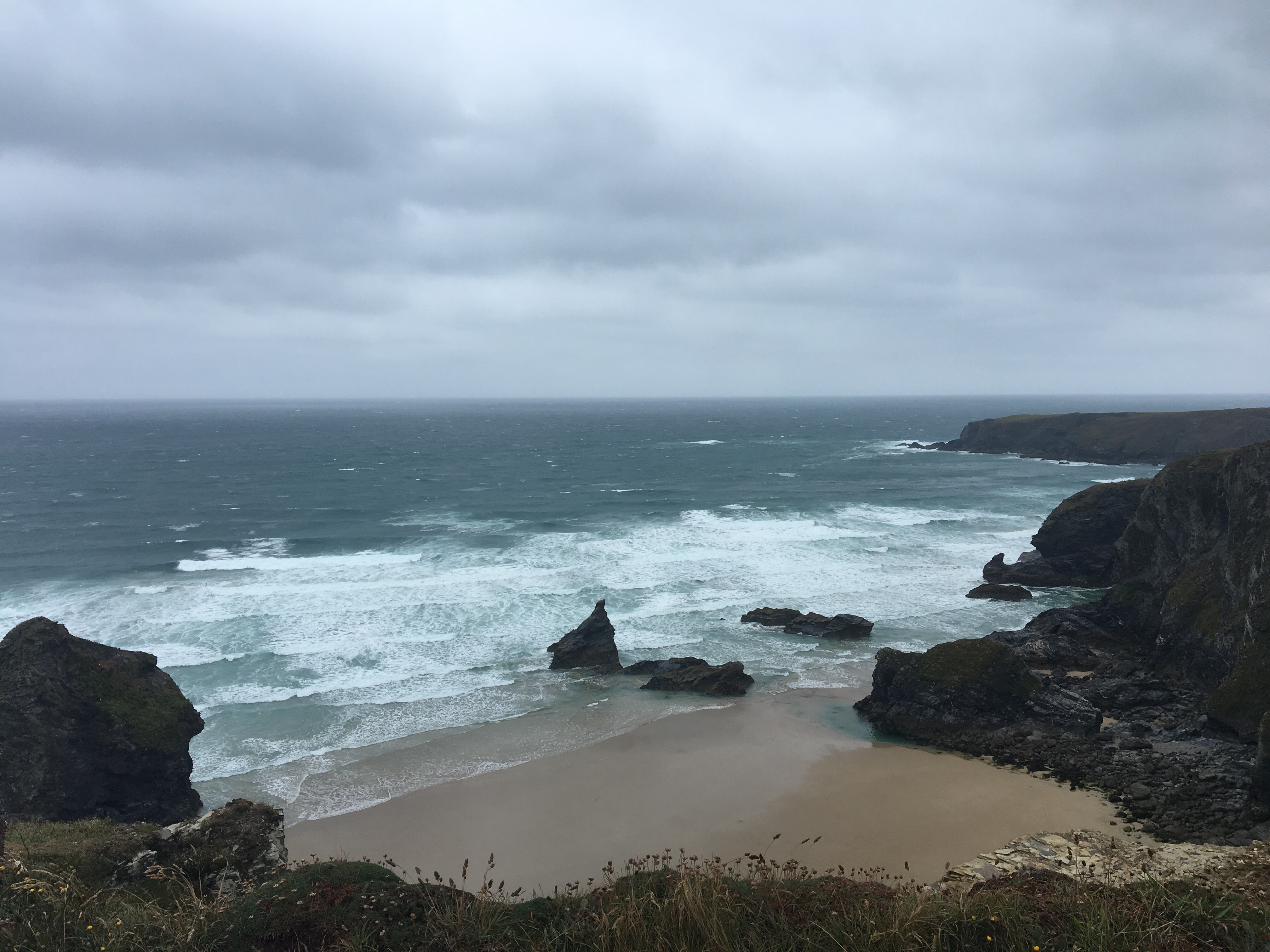
Back at Zennor to start Cath and I met the breakfast chef at the Tinners Arms who revealed she had lost her husband to Prostate Cancer 3 years ago, so I set off already with a lump in my throat. The coastal path was wetter due to rain overnight but there was little wind so everything seemed very still. Time seemed to pass quite slowly at first as I climbed round a series of small headlands and coves, past the Gurnards Head and some wild ponies

 before reaching the rocky cove at Bosigran where some important filming was taking place. Several security staff, some cameramen, spotters and a couple of “action men” getting ready for the shoot. All I could obtain was that it was some sort of cliff and rock climbing safety video, so decided not to hang around – then as I left the helicopter arrived, presumably with the reason for the security inside. Very exciting but I had to make tracks so it will remain a mystery.
 Sometime later as the day got warmer I made it to Pendeen Watch lighthouse and stopped for a short break.
 With no phone signal I decided to leave the coast path and head inland for a few miles through Pendeen to St Just where I managed to get my blog up to date. My phone then started to explode with texts, mails and FB messages wishing me luck on my last day – I began to wonder how tough it was going to be emotionally over the last few miles. I hit the coast path again near Cape Cornwall and almost immediately got my first sight of Lands End on the horizon.
  Significantly I reached the last of my printed OS route maps – another moment which brought home the scale of this adventure and the unavoidable fact that I was nearly there.
I got to Sennen Cove and stopped with about 1 mile to go to try and compose myself for what was to come. 
 I was fine for the next half mile until two unknown gentlemen stopped, congratulated me and presented me with a couple of Prostate Cancer UK balloons. I realised then that something had been planned for my arrival and knew it would be very hard to manage my emotions from there on. As I crested the final brow I could see a group of people gathered by the signpost and as I got closer the applause and cheering started. There was even a klaxon going off. I began to recognise the people I knew (Cath, Shirley, Cazzy and Penny and Mick Howard all wearing PCUK t-shirts holding a banner with a montage of photos from this trek) and a crowd of tourists and visitors all cheering me home. Those last 100 yards were amongst the hardest of the entire trek – the tears welled up behind my sunglasses, I walked to Cath (my rock of support for the last 9 weeks) hugged her and just cried as the raw emotion took over. (I just re-lived all of that as I wrote it, by the way, and it took a while to get that down…). When I managed to compose myself it was time for photos and introductions to Mark and Joanne Travis who had come welcome me on behalf of Prostate Cancer UK and helped Cath organise the balloons, t-shirts etc.
 After a celebratory drink I took a moment before leaving LE to try and just savour this last experience alone by the First and Last Inn.
 I’m sure I’ll re-live parts of this walk over and over and will carry with me memories for a lifetime. I’ve done 1211 miles End to End on foot in 63 days, my GPS tells me I’ve climbed over 200,000 feet but I don’t believe that. Anyway I’ve probably done at least 4 Mount Everests. I don’t have all the step data as I was phoneless for several days through the middle but it’s going to be about 2.5 million. What is most important though is that we (that’s everyone involved) have managed to raise in the end over £5000 for Prostate Cancer UK, and hopefully done our bit to help generate more awareness along the way. I have a massive list of people to thank (they will know who they are) and will deal with that separately. Time to celebrate!!!

 but by the time I got to St Ives the sun was coming out and it was warming up nicely.
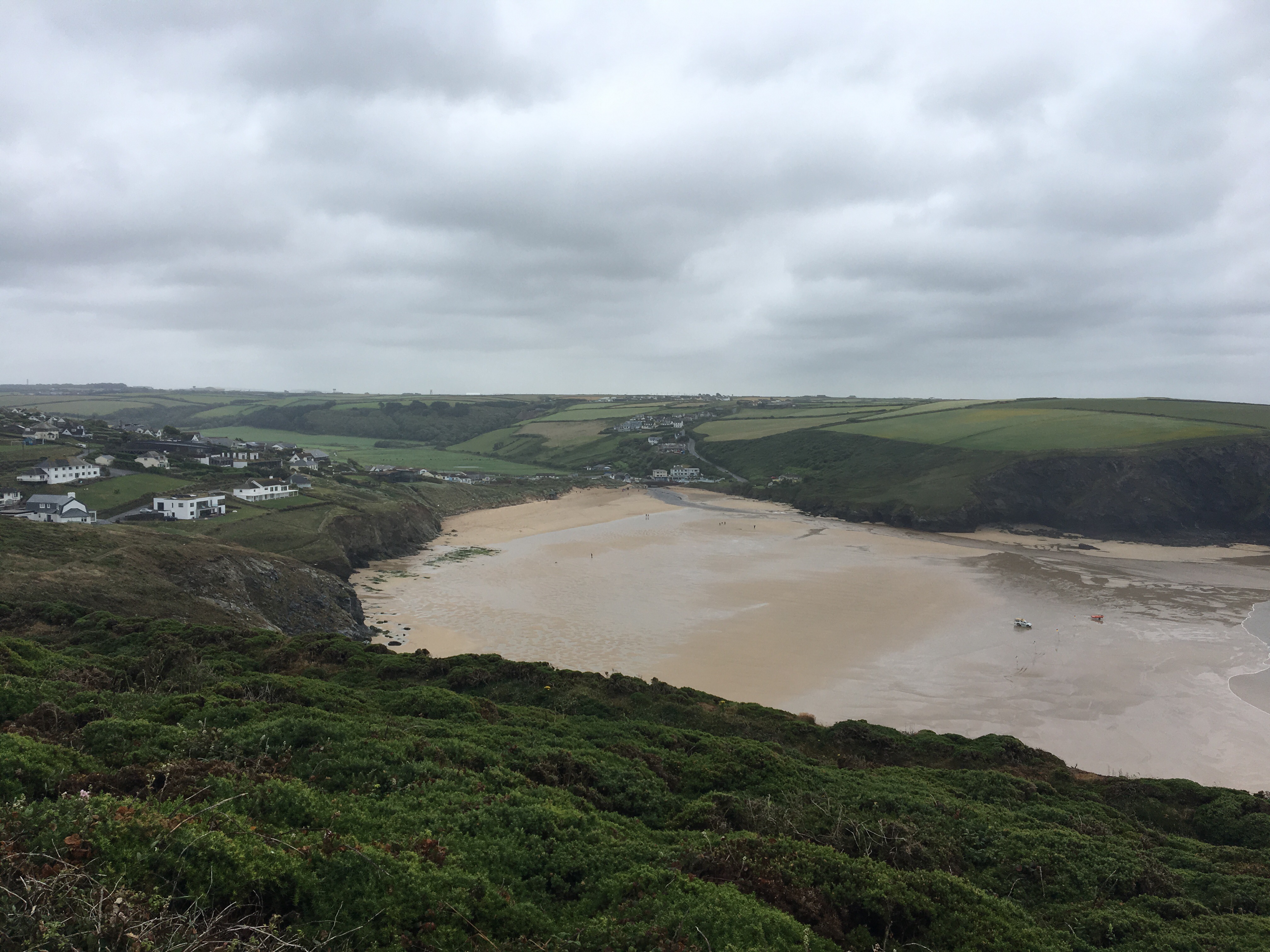
 St Ives was very busy but I stopped for a coffee and a bite to eat then headed onto the coastal path for the afternoon. Once more there was some good coastline but the walking was just difficult because of the terrain, not particularly steep but muddy, rocky and overgrown in places.
 After a relatively short day I got to Zennor in great time and a deserved beer at the Tinners Arms where Cath, Cazzy and Shirley had come to meet me.
 We drove back to Trevalgan camp site and then later back to Perranporth where we met up with Ally (remember him my fellow JOGLER?) for a good meal, some beer and loads of stories from the last 9 weeks. Then it was off to bed dreaming of the final day…

 More views of rugged coastline followed as I covered the next few miles towards Godrevy point, passing Hells Mouth and a small colony of seals along the way (can you spot them?)


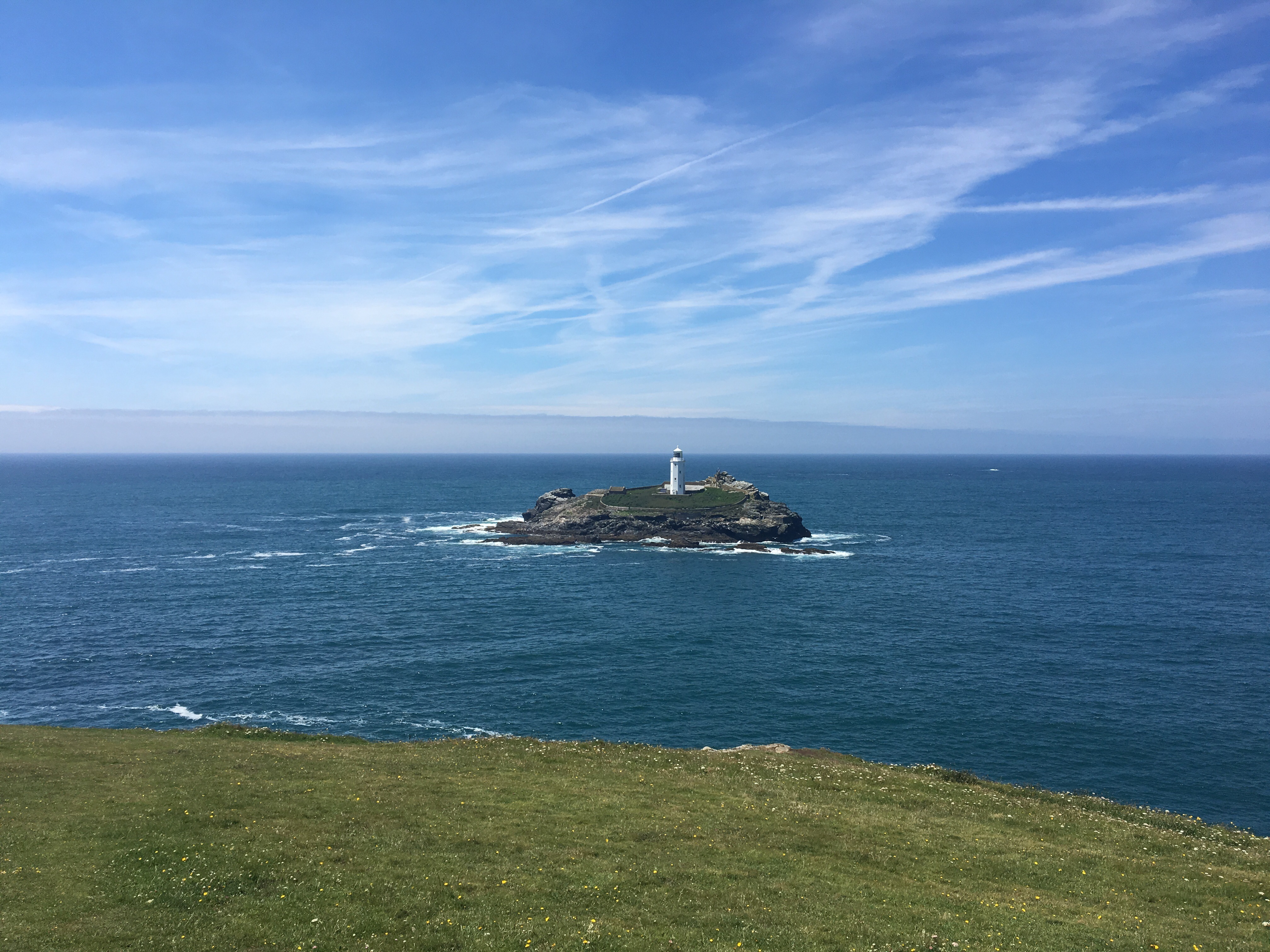
 Feeling good and way ahead of time I decided not to miss out Godrevy point and took the longer route around the headland to get a closer look at the lighthouse.
 After a brief rest and some reflection on this trek (difficult to take it all in in one go) the last mile or so into Gwithian was easy and I arrived at the camp site before Cath and Betty. A quick check on social media revealed she had been down to Perranporth beach. When she arrived in Gwithian she brought with her the surprise of Cazzy and Shirley who have driven down from Staffordshire to join us for the last couple of days. If anyone is asking – Shirley is not walking with me and she has not brought rain with her – at least not yet!!!


 The walk was mostly sheltered from the wind but by the time I reached Padstow harbour I was once again saturated.
 I had made good time and crossed the beach at Mawgan Porth in good spirits before climbing the last mile or so up to Trevarrian where the campsite is quite exposed and still extremely windy.


 I shortcutted the coastal path around the headland and headed west on minor roads to join it finally at Greencliff. I could see Lundy Island across the sea and the white splash of Clovelly tumbling down the distant cliffs.
 My first taste of the SWCP was pretty much what I expected – a few steep ups and downs to cover before arriving at Peppercombe where I decided to go along the shore rather than the cliffs. An hour later after a difficult walk over rocks, boulders, pebbles I had covered another 2 miles to Bucks Mills. Will stick to the cliff path in future!
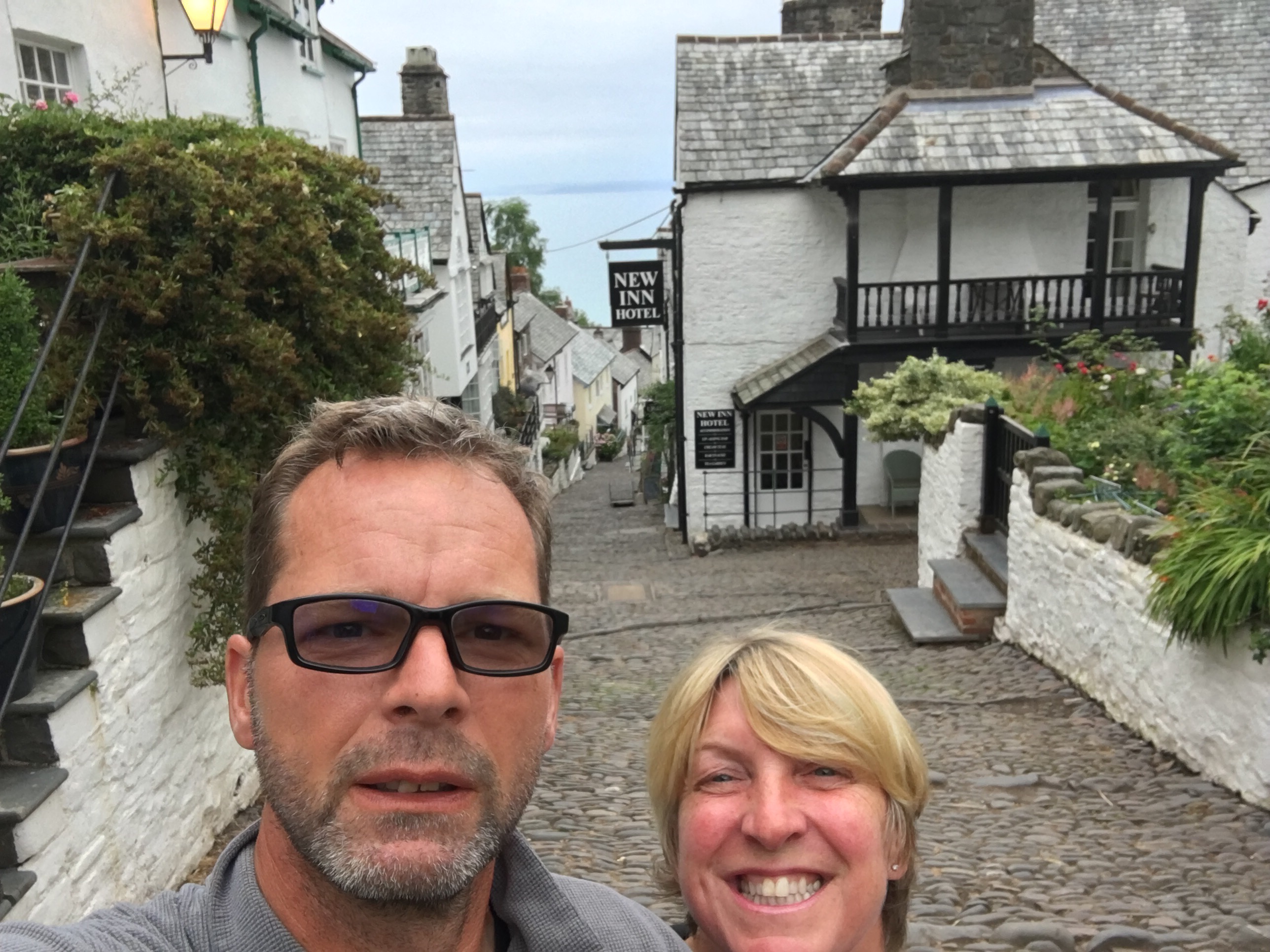
 I climbed steeply back up to the cliff path and followed it through woods and fields before the last 2 miles along the Hobby Drive to meet Cath at Clovelly. We decided to wild camp on the visitor centre car park and eat tonight in the village.
 Tomorrow the toughest part of the SWCP down to Bude…..


